

IMD forecasts possible cyclonic storm formation over the Bay of Bengal by October 26, with rain likely in parts of West Bengal from October 27
Thank you for reading this post, don't forget to subscribe!October 24, 2026|CoreSignal
Bay of Bengal Cyclone Alert: IMD Issues Warning
A weather system developing over the Bay of Bengal could intensify into a cyclonic storm early next week, according to the India Meteorological Department (IMD). The system is forecast to move towards the Andhra Pradesh and Odisha coasts, while parts of West Bengal could experience rain and gusty winds from Tuesday.
The system’s track and intensity may change as it develops. Although the current forecast points towards the eastern coast of southern India, its possible impact on West Bengal remains a concern for the coming days.
Bay of Bengal System May Intensify by October 26
The IMD is monitoring a low-pressure system over the east-central and adjoining southeast Bay of Bengal. According to the weather department’s October 24 bulletin, the system is expected to strengthen into a depression before potentially developing into a cyclonic storm by the morning of October 26.
The system is forecast to move west-northwestwards towards the west-central Bay of Bengal. Its projected movement could bring adverse weather conditions to parts of the eastern coastline, although the exact path and intensity remain subject to change.
Rain Forecast for West Bengal From October 27
Parts of West Bengal could experience rain from Tuesday, October 27, as the weather system develops over the Bay of Bengal. Forecasts indicate the possibility of light to moderate rainfall, with isolated heavy spells possible in some areas later in the week.
Kolkata and other parts of southern Bengal may also see changing weather conditions. The distribution and intensity of rainfall will depend on the system’s movement and subsequent IMD forecasts.
Murshidabad Weather Outlook
The impact on Murshidabad will depend on how far the system’s influence extends inland. Further updates will be needed to establish whether the district is likely to experience significant rainfall or strong winds.
Residents should check district-specific forecasts before making decisions about outdoor activities, travel and agricultural work. No district-level warning should be assumed unless it is confirmed by the weather department.


District-Wise Rain Forecast for West Bengal: October 27–29
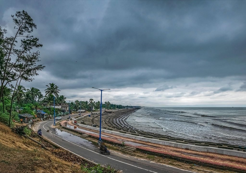
October 27: Rain May Begin in Coastal Districts
The developing weather system over the Bay of Bengal could bring rain, thunderstorms and gusty winds to several districts of southern West Bengal between October 27 and 29. Coastal districts are among the areas to watch, with the possibility of heavier rainfall towards the middle and latter part of the week.
South 24 Parganas and Purba Medinipur (East Midnapore) are among the districts to watch on Tuesday. Light to moderate rain may occur in isolated places, while light rain is also possible in Paschim Medinipur, Jhargram, North 24 Parganas, Howrah and Kolkata. Thunderstorms and gusty winds may affect some coastal areas.
October 28: Heavy Rain Possible in Four Districts

South 24 Parganas, Purba Medinipur, Paschim Medinipur and Jhargram are among the districts facing a greater risk of heavy rain on Wednesday.
The reported forecast indicates that rainfall could reach 70–110 mm in affected areas. Gusty winds of around 40–50 km/h are also possible in these districts. Residents should monitor updated weather warnings, particularly in low-lying areas and locations vulnerable to waterlogging.



October 29: Rain Risk Extends to Western Districts

On Thursday, Paschim Medinipur, Jhargram, Bankura and Purulia are among the districts to watch for heavy rain. Rain may also occur across other parts of southern West Bengal, accompanied by gusty winds in some areas.
The actual distribution and intensity of rainfall will depend on the weather system’s movement and subsequent forecasts.
Murshidabad Not Specifically Listed for Heavy Rain
Murshidabad was not among the districts specifically highlighted for heavy rainfall in the district-level report cited here. However, this does not rule out rain or changing weather conditions in the district. Residents should check the latest district-specific forecast before making travel or agricultural decisions.
The district-level outlook was reported by Aaj Tak Bangla. For official updates, refer to the IMD’s subdivision-wise weather warnings.
Fishermen Warned as Sea Conditions Deteriorate
The developing system is expected to affect sea conditions over parts of the Bay of Bengal. The IMD has issued marine weather advisories for specified areas, with fishermen urged to follow restrictions during the relevant warning periods.
Fishermen and coastal communities should monitor updated bulletins because the affected areas and warning periods may change as the system develops.
IMD Forecast May Change as System Develops
The next few days will be important in determining the system’s strength, movement and likely impact on eastern India. Residents of West Bengal should rely on updated official forecasts rather than unverified claims about the cyclone’s path or landfall.
The latest information is available through the IMD Kolkata coastal weather bulletin and the India Meteorological Department website.
Disclaimer: Forecasts may change as the system develops. Readers should follow the latest IMD bulletins for updated rainfall estimates and district-specific warnings.