Earthquakes Last 24 Hours: A 6.8 Tremor in Timor-Leste
Share Copy Link copied Spotted something off? Tell the desk about queries, objections or corrections: Home | Contact Us Gloabal Earthquake 222 Earthquakes in the Last 24 Hours: A 6.8 Tremor Near Lospalos in Timor-Leste Leads the List The tremor, 143 km under the Banda Sea, rattled homes in Darwin more than 600 km away,…
 Spotted something off? Tell the desk about queries, objections or corrections: Home | Contact Us
222 Earthquakes in the Last 24 Hours: A 6.8 Tremor Near Lospalos in Timor-Leste Leads the List
The tremor, 143 km under the Banda Sea, rattled homes in Darwin more than 600 km away, while the USGS recorded no reports of damage.
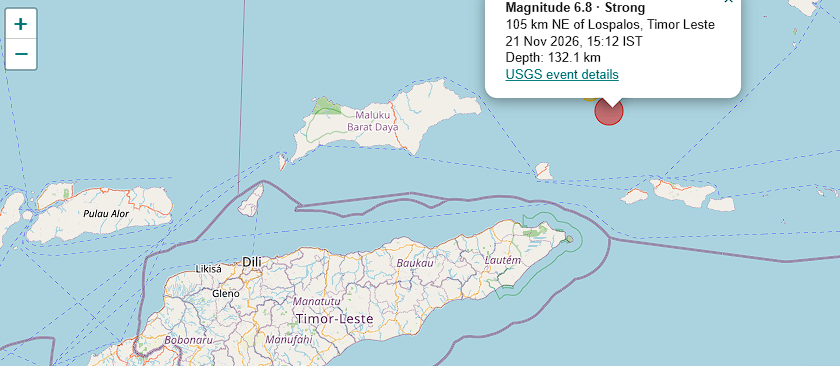
Earthquakes in the last 24 hours numbered 222 worldwide, with 11 of magnitude 4.5 or higher, according to the latest tracking tally. The strongest was a magnitude 6.8 earthquake about 103 km north-east of Lospalos in Timor-Leste on 21 November 2026, recorded by the US Geological Survey (USGS) at 09:42 UTC, or 3:12 PM in India.
The quake struck deep, at 143 km, which kept the shaking moderate near the epicentre. It was still strong enough to be felt in Darwin and across Australia’s Top End, where ABC News reported that residents heard walls and ceilings moving.
What the Instruments Recorded Near Lospalos
USGS puts the magnitude at 6.8 and the depth at 143 km, with the epicentre at sea 103 km north-east of Lospalos, the main town of eastern Timor-Leste. Geoscience Australia gave the same magnitude. The USGS impact estimate carried a green alert, its lowest, with maximum shaking at intensity 5, described as moderate, and its entry reported no damage or casualties. The agency’s page for the event did not mention a tsunami.
The location is labelled differently in different reports. Some outlets describe it as lying in Indonesia’s Southwest Maluku islands, since the epicentre was in the sea between Timor and the Banda Sea islands, while the USGS names Lospalos as the nearest town.
Felt in Darwin, Katherine and Eva Valley: Earthquakes Last 24 Hours
Geoscience Australia said it received more than 1600 reports from people who felt the shaking, which arrived around 7:15 PM local time on Saturday. A resident of Bayview in Darwin called it the strongest quake she had felt in the city, and in Eva Valley, about 110 km south of Darwin, ceiling fans swung and the concrete floor seemed to move. Tremors were also reported in Katherine, about 320 km south-east of Darwin.
Why a 6.8 at This Depth Shook Homes Without Collapsing Them
An earthquake at 143 km is an intermediate-depth event, and its energy spreads over a wide area before reaching the surface. That usually produces broad, rolling shaking over hundreds of kilometres, not the sharp damage a shallow quake of the same size would cause directly above it. A separate alert from the Global Disaster Alert and Coordination System estimated around 50000 people were exposed to shaking of intensity V, which is felt by nearly everyone but rarely damaging.
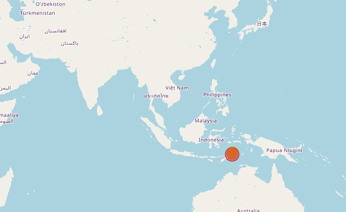
The region sits where the Australian plate dives under the Banda arc, one of the most seismically active zones in the Indonesian archipelago. Quakes of magnitude 6 to 6.9 happen more than a hundred times a year worldwide, so a 6.8 is strong but not rare.
The Banda Sea Has Now Had Two Strong Tremors in Five Days
Darwin had already felt lighter shaking days earlier from another quake in the Banda Sea, about 700 km north of the city. Indonesia’s weather and geophysics agency BMKG measured that one on 17 November at 6.8 after revising an initial 7.1, at a depth of 97 km and about 132 km south-west of Southeast Maluku, with no tsunami threat from its modelling, as The Star reported citing Bernama. ABC described the earlier quake as 6.6, which reflects the usual gap between agencies’ first estimates. The two are separate earthquakes, and no link between them has been reported.
Reading the Daily Tally of 222 Earthquakes
A count of 222 in 24 hours sounds alarming but is an ordinary figure, because most of those are small tremors that are recorded by instruments and never felt. The 11 events of magnitude 4.5 or higher are the ones that tend to make news, and only one of them reached the 6s. The tally shifts every hour as networks add events and update magnitudes, so a different tracker can show a slightly different number for the same day.
For live updates, the USGS earthquake map lists every recent event with its depth and any felt reports, and local agencies such as BMKG and Geoscience Australia publish their own readings.
